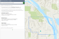
The Zone Lookup configurable app template allows you to create apps that return information about a predefined area (a zone) that spatially coincides with the location specified by the app user.
As the app creator, you define the zone or zones by including one or more polygon layers that represent the areas for which the app user needs information. When the app user searches for or selects a location on the map, the app finds the intersection of that location with the zone polygons you've defined. A pop-up appears to show what zone that location is in.
For example, your app could help people determine what congressional district they live in. Your zones (the features in your polygon layer) define the spatial area of each congressional district. When app users input their address in the location search, the app finds what congressional district that address is in and returns a pop-up with information about that district.
See the Introducing Zone Lookup blog post for more information and examples.
Options
To see the options available for this template, search your ArcGIS Enterprise portal using the app template name and open the app template item's detail page.
Requirements
The map you use in the app must contain one or more polygons that define the zones. Your portal must have at least one geocoding utility service configured to allow app users to search for addresses or places.